Ir para o conteúdo

Blogoosfero verdebiancorosso

Voltar a Disinformatico
Tela cheia Sugerir um artigo

Russian meteor path plotted in Google Maps

14 de Fevereiro de 2013, 22:00 , por Desconhecido - 0sem comentários ainda | No one following this article yet.
Visualizado 54 vezes
Copyright EUMETSAT

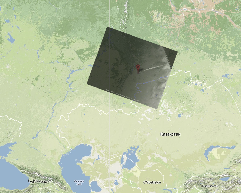
Meteosat-10 image of meteoroid trail aligned with Kazakhstan border in Google Maps.
Credit: Paolo Attivissimo
I've taken the Meteosat-10 image of the Russian meteoroid trail and used the Kazakhstan border that is digitally superimposed on Meteosat-10 images to align the image with the border in Google Maps. The result is shown above. The letter A indicates the city of Celyabinsk. The trail would appear to extend for approximately 320 kilometers (200 miles).

I hope this is useful in reconstructing the trajectory of the meteoroid. Please feel free to use the composite image: just link back to this post or mention my name (Paolo Attivissimo) in the credits.

Italiano: ho preso un'immagine del satellite Meteosat-10 che mostra la scia della meteora e l'ho allineata con Google Maps. La lettera A indica la città di Celyabinks. La scia risulta lunga circa 320 chilometri. Spero che quest'analisi possa essere utile nella ricostruzione della traiettoria e della velocità della meteora.

Fonte: http://feedproxy.google.com/~r/Disinformatico/~3/UMkrL0Cj6xk/russian-meteor-path-plotted-in-google.html

0sem comentários ainda

    Enviar um comentário

    Os campos realçados são obrigatórios.

    Se você é um usuário registrado, pode se identificar e ser reconhecido automaticamente.

    Cancelar